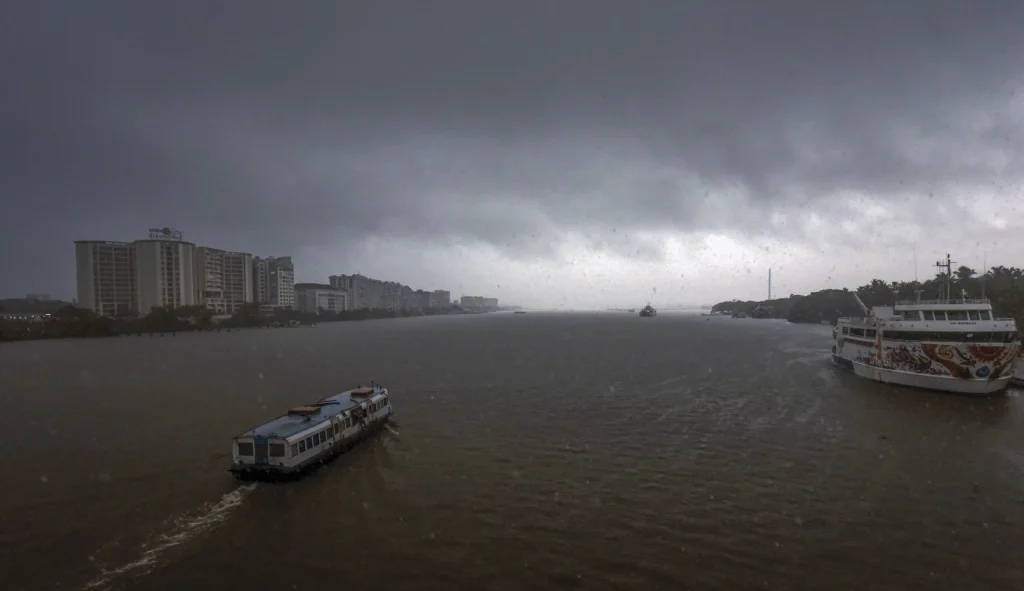
Dragged by cyclone Remal, monsoon hits Kerala, Northeast ahead of schedule
Spurred on by Cyclone Remal, southwest monsoon is expected to hit parts of the northeast along with the Kerala coast from today (May 30).
While the onset is a day ahead of the date forecast by the weather office for Kerala, the normal monsoon onset date for Arunachal Pradesh, Tripura, Nagaland, Meghalaya, Mizoram, Manipur, and Assam is June 5.
Remal effect
Weather scientists said Cyclone Remal, which ripped through West Bengal and Bangladesh on Sunday, had pulled the monsoonal flow to the Bay of Bengal, which could be one of the reasons for the early onset over the north-east.
Kerala has been receiving heavy rains for the past few days resulting in a surplus May rainfall, the weather office data showed.
Early onset
“Conditions continue to become favourable for the onset of the southwest monsoon over Kerala during the next 24 hours,” the India Meteorological Department said on Wednesday.
On May 15, the weather office had announced the onset of monsoon over Kerala by May 31.
“The conditions also continue to become favourable for further advance of Southwest Monsoon into some more parts of South Arabian Sea, remaining parts of Maldives, Comorin, Lakshadweep, southwest and central Bay of Bengal, northeast Bay of Bengal and some parts of Northeastern states during the same period,” the IMD said.
All eyes on monsoon
The IMD declares onset of monsoon over Kerala if over 14 stations there and neighbouring areas receive 2.5 mm or more rainfall for two consecutive days any time after May 10, the Outgoing Longwave Radiation (OLR) is low, and the direction of the winds is south-westerly.
Monsoon is critical for India’s agricultural landscape, with 52 per cent of the net cultivated area relying on it. It is also crucial for replenishing reservoirs critical for drinking water, apart from power generation across the country.
June and July are considered the most important monsoon months for agriculture because most of the sowing for the Kharif crop takes place during this period.
El Nino and La Nina
El Nino conditions are prevailing at present, and La Nina may set in by August-September, scientists say.
El Nino — the periodic warming of surface waters in the central Pacific Ocean — is associated with weaker monsoon winds and drier conditions in India. La Nina — the antithesis of El Nino — leads to plentiful rainfall during the monsoon season.
Indian Ocean Dipole
The IMD is also anticipating the development of a positive Indian Ocean Dipole (IOD) or cooler-than-normal Indian Ocean in the east compared to the west, which helps bring rain to several states in southern India.
The IOD is currently “neutral” and is expected to turn positive by August.
Another factor is the below-normal snow cover in the northern hemisphere and Eurasia. Historically, there has been an “inverse relationship” between the levels of snow here and the monsoon.
(With agency inputs)
!function(f,b,e,v,n,t,s) {if(f.fbq)return;n=f.fbq=function(){n.callMethod? n.callMethod.apply(n,arguments):n.queue.push(arguments)}; if(!f._fbq)f._fbq=n;n.push=n;n.loaded=!0;n.version=’2.0′; n.queue=();t=b.createElement(e);t.async=!0; t.src=v;s=b.getElementsByTagName(e)(0); s.parentNode.insertBefore(t,s)}(window, document,’script’, ‘ fbq(‘init’, ‘656934415621129’); fbq(‘track’, ‘PageView’);


